Showing posts with label appalachian trail. Show all posts

Monday, March 27, 2017

Crabtree Falls, VA family hike.

Crabtree Falls is the highest vertical-drop cascading waterfall east of the Mississippi River. It features a series of five major cascades and a number of smaller ones that fall a total distance of 1,200 feet.

i've been wanting to visit Crabtree Falls for a while, and this weekend we finally got a chance to hike it! It's was a little farther than we usually drive for a day hike (over 2 hours) but it was very worth it.


This bridge is the Crabtree falls arch bridge and is near the parking lot. i thought this was so beautiful. We couldn't walk across it though, it was closed for safety reasons. i don't know whether they plan to repair it or what. It didn't say, just said it was closed to foot traffic. 


 The falls are absolutely amazing, and much larger than they look in the photo.  The hike was very strenuous. We just kept going up and up and every time we thought we were at the last falls, we'd seen more.  It's was just breath taking.


 There are several rests along the way. Benches, and overlooks.  It was really busy when we were there. Really more crowded than i like for a hiking adventure, but the falls made it worth it.


There was just no way to get a picture of the entire falls, so i snapped a photo at each of the outlooks.  The path was muddy and slippery in places. It was not an easy hike, yet we saw people of all ages and physical shape hiking to the top.  Lots of people had dogs, and several had babies in back carriers.  So although it's a strenuous hike, it's very doable. Just take it slow and stay on the trail.


There are warning signs all over the trail.  30 people have died at Crabtree Falls since the U.S. Forest Service began keeping records in 1982.  There are many signs reminding of the dangers here.  The hike is safe as long as you stay on the trails.


At the very top is an outlook with spectacular views. You can't see the falls from the top, but it's a nice spot to rest and take it all in. There were a lot of people at the top. Several had brought hammocks and were set up enjoying the views. There is a large open rocky area to sit.  After resting we went back down the same way we came up. i believe you can continue on the trail toward Crabtree meadow, and eventually connecting up with the AT. 

We are really looking forward to this warmer weather so we can get back to hiking and kayaking every weekend!

Monday, February 20, 2017

Climbing the Devil's Marbleyard- Q-band fitness tracker review. #getoutside


This weekend we decided to explore another area of the Appalachian trail.  Devil’s Marbleyard is a boulder field near Natural Bridge Virginia. 


The landscape is covered in huge rocks, many that are the size of cars. Picture really do not do this place justice. Can you see that pink dot in the center of the photo? that's my daughter.  This place is really wild!  We really didn't know what to expect when we decided to come here and hike. Kenan said it was 1.5 miles to boulder field, 3 miles round trip. So i wore, a skirt and crocs which is what i typically wear hiking.


i did not realize we'd be climbing to the top of the boulder field, or i would have dressed much different. There isn't a trail through the boulder field, although there is one off to the side. We chose to climb the boulders. We really had no idea what we were getting into. Can you see the three black dots along the edge of the rocks in the back? i'm the one in the center. i was a bit behind everyone else, trying to scale rock faces in an ankle length skirt. 


The view is absolutely amazing.  This picture is quite misleading, as it looks like the top. However, once you get to this point, there is a whole other  boulder field on the other side.  i truly wanted to cry.


Those trees up ahead? Yeah, that's the top.  


Usually i'm the one to take all the pictures, but i had Kenan hold my camera so i could finish the climb easier. i'm almost at the top here, and my legs have almost turned to jello. i really didn't know if i was going to make it.


Not only did i make it to the top, but my fitness tracker gave me a thumbs up!! i've been wearing it for about a week to track my steps. Since i don't move much in the winter time i'm lucky if i get 50% of my steps in on a regular day. So as silly as it is, i'm very proud of this.


The view from the top, is incredibly beautiful. There were so many trees at the top, that we couldn't really see the boulder field we had just climbed. There were a few cliffs and places that overloaded it, but there were quite a few people up there already occupying those spots, so we didn't bother trying to get closer just for a picture.  Honestly, by the time we got to the top i was just ready to go home.  Rather than climb back down the boulders, we took the trail on our way down. It was challenging as well, because the ground was soft and sandy and very steep.  


So now that we are starting to have a few nice days, we plan to be out hiking every weekend possible. i thought this would be a great opportunity to review my new Q-band fitness tracker!  It has Wireless Bluetooth Synchronization with iPhone & Android Devices. It keeps track of steps, calories burned and a sleep tracker. It uses the i-gotU Life app, it can also sync to Apple Health or Google Fit. i'm still figuring out all the features. It notifies me when i get fb notifications, emails, phone calls etc and also tells me when i've been sitting for too long. lol.   The app is easy to use, and keeps track of steps, calories and sleep. So far it seems to be a pretty good step counter, and i'm having fun keeping track of my steps and creating fitness goals.  My only criticism is that it doesn't keep track of heart rate. This is just the basic model, but they do offer a more advanced model that does have the heart detection.  i may end up investing in that one later on, so far i am really enjoying keeping track of my steps, and it motives me to do more when i'm not being active enough.

This one is  available on amazon for $49.99 shipped free with prime.  https://www.amazon.com/dp/B01MS5I5UU

i'm already getting excited about the spring. We have so many places we want to hike, kayak and camp. Our weather has been unseasonable warm for February, so i'm really getting the spring fever itch.  This year being more active is a huge goal for the whole family. We all spend too much time online, so getting outside and offline is really important.  We hiked parts of the Appalachian trail last year, and plan to hike several different parts this year.

The Devil's Marble yard is definitely an experience!  Make sure you are wearing good hiking/climbing shoes, bring a water and snacks! We were so unprepared for it. The pictures make it look like relatively flat, but rocky terrain. It's actually very steep, with huge boulders and deep crevices. Although you probably won't fall to your death climbing the boulders, breaking an ankle or cracking your skull are real possibilities! My kids absolutely loved it though, and we all had a pretty amazing time. Definitely one of the more challenging hikes we've done, but very worth it!


*i received the Q-band fitness tracker in exchange for my honest and unbiased review, my opinions are my own.

Tuesday, April 5, 2016

Spring Break 2016- Amicalola Falls

The kids never really get much a spring break. It is almost always the Friday and Monday of Easter weekend.  So it's a 4 day weekend, but really only 2 days off of school. Not enough time for a Florida trip to visit my folks, but perfect for a weekend get away.  

This year we decided to visit Atlanta Georgia to check out the zoo and Aquarium. i always prefer outside activities that don't involve crowds of people, so we fit in a waterfall hike on our way home. 

 Amicalola Falls State Park is a little ways north of Atlanta, and easy to fit into our route on the way home. Amicalola Falls is Georgia's tallest waterfall at 720 feet. This is also the southernmost point of the Appalachian Trail. 


The trail up to the falls is breathtaking. The Amicalola falls loop trail is only 2.1 miles, but it is almost entirely stairs (or at least it feels that way) so it was a pretty strenuous hike. The creek was filled with little falls and rapids, but the big falls are up in the right hand corner of the picture. Hard to see with the brightness. 


The closer we got, the more amazing it seemed. The energy from the falls is almost overpowering. 


The boys had no problem with the hike, but my girl and i were feeling very out of shape.  


Stairs, stairs and more stairs.


We stopped to rest and take in the magnitude of the falls. Then continue up to the very top of the falls.


The view was just unbelievable. 


The view looking down. 


We didn't actually go all the way to the A.T. approach trail, but were still pretty excited to be so close to where it begins (or ends).  My husband is already making plans to hike the A.T. with my boy when he graduates high school.  We've hiked small portions of it together as a family, and although i love the idea of hiking it from beginning to end, i'm not sure i could be away from home (and my animals) that long.  i would love to one day hike all of it, but do it in small stretches at a time not all at once.

The Amicalola falls are really spectacular and i despite all those stairs, it is definitely worth the hike! 


Friday, April 10, 2015

McAfee's Knob- Appalachian Trail hiking

This past weekend the weather was fantastic and so we decided to hike another spot on the Appalachian trail. We decided on McAfee's knob which is located very close to Dragon's tooth, where we hiked the previous weekend. McAfee's knob is the most photographed site along the AT. The Knob has an almost 270 degree panorama of the Catawba Valley and North Mountain to the west, Tinker Cliffs to the north and the Roanoke Valley to the east. The hike is almost 8 miles round trip, which is a pretty long hike for us.


So before leaving, Kenan googled the directions.  All was well, until we went to turn down the road listed in our directions as the route to McAfee's knob. Ha ha.  This sign completely cracked me up. 'Don't let me have to shoot your ass" ha ha. This poor guy must deal with AT hikers constantly who trusted the google directions. So we sat in the driveway and looked up different directions to access it. We figured out that we had to go back to the Appalachian trail access parking lot, and follow the trail from there. Although the lot was marked for the Appalachian trail access, there was no obvious sign that it was the way to McAfee's knob.  We had to look on the AT map on the Kiosk. They also had a porta-jon  for before you get started,which is helpful if you're hiking with kids:) 


Once you get going, you'll see the signs. :)


Wildflowers were just beginning to bloom.  We spotted a bunch of these spring beauty, also saw forsythia, wood violets and a pretty white flowering tree. The hike itself was a bit strenuous if you are completely out of shape like i am. 


All along the AP are these shelters. There is two day limit on them i believe, but folks can staty here to get out of the rain or set up camp if they are stopping. Each one had a journal where folks who stayed at them could leave their name or write whatever they were feeling. i thought it was pretty neat.  My girl exhausted from hiking, laid every chance she could get.


Stopped for a picture break. We stopped for a lot of breaks. :) These white flowering bushes were everywhere, not sure what they were.


The views at the top were amazing.  It was definitely worth the hike. 


i  told them to go out on the rock, but i would let them walk all the way to the end. hee hee. Made my knees weak just watching them. 


i took a ton of pictures.  It was really an amazing overlook.


Some kind man offered to take our pictures, which is always nice because i'm typically never in the pictures. However i was munching away on a granola bar and had a mouth full that i couldn't get swallowed before he started snapping pictures. So i've got the chipmunk cheek look because my mouth was full and i couldn't smile. lol.

That bit of white in the distance on the right is the Roanoke Valley.

Although this hike definitely kicked my butt, it has really made me want to get into better shape so we can do more of these AT hikes.  The husband is already making plans to do the AT with my boy when he graduates high school. i'm not sure i'd want to do the entire AT at one time, but i love the idea of hiking different parts of it at different times. 


"Climb the mountains and get their good tidings. Nature's peace will flow into you as sunshine flows into trees. The winds will blow their own freshness into you, and the storms their energy, while cares will drop off like autumn leaves. As age comes on, one source of enjoyment after another is closed, but Nature's sources never fail." ~John Muir, Our National Parks

Tuesday, April 7, 2015

Dragon's tooth- Appalachian trail hiking

In the spring,  we like to take advantage of the beautiful weather get outside and hike any chance we can. We are in the prime area for hiking. We are centrally located to the New River Trail, the Blue Ridge parkway and the Appalachian trail. We also have many other local places to hike like Buffalo Mountain, Rock Castle Gorge and the Cascades.

We hike all of local places each year and have been working our way down different parts of the New River trail.  This year, we began looking for different areas of the Appalachian trail to hike.

Our first  AT hike of the spring was Dragon's Tooth. Dagon's Tooth is a unique geological feature that consists of Tuscarora quartzite spires which outcrop on the top of cove Mountain. The tallest tooth projects roughly 35 feet above the surrounding rock. The trail to Dragon's tooth ascends steep, rugged outcrops of quartzite which form the spine of Cove Mountain and North Mountain. The spine is known as Dragon's back.

This was a pretty difficult hike, for us having sat on our butts all winter. It is only 4.5 miles round trip, but it is very strenuous and the terrain is extremely rough in spots.  


Several areas of this hike require you to actually scale the rocks. They do have hand grips in some of the rocks, but some of them like this picture did not. climbing up this area was much scarier than climbing down. It is hard to how steep this area actually is in the photo, but it felt like we were having to climb straight up the rocks. what you can't see in these pictures, is that there is a pretty good drop off next to the trail on the bottom. Making this the most terrifying part of the hike. 


Both hands and feet are required to get down the rocks here.  Coming down was much easier than going up.  Honestly, i was surprised by the amount of older folks, kids and dogs that were hiking.  This is not an easy trail, and i would not take little kids on it. My kids are 8 and 13 and did fine, but there were some scary areas, narrow legdes and the climbing was pretty strenuous and difficult in parts.


i didn't get any photos of the climb up, because we had to use both hands and were just concerned with the climb. Kenan was the first to climb down, so he snapped a couple pictures of us descending. It is a very hands on hike. You have climb using both hands and feet and sometimes knees as well.


The views at the top make the hike completely worthwhile. The views are truly incredible.


At the top of Dragon's tooth, we rested and had some snacks before heading back down. 


Had to take a selfie of course. ;)


i would have loved to get  a picture of my family sitting where the guy in the orange shirt is, but we had to settle for the base of the 'tooth'.  It's hard to see, but that's my family standing in the shadow. It's give an idea of how large the quartzite formations are. 


This was a great hike to start the year, although it was much more challenging than many of our other hikes we truly enjoyed it. Looking forward to exploring more places along the Appalachian trail this spring/summer.  We all need to work on getting in better shape though, the AT is serious hiking.


"Keep close to Nature's heart... and break clear away, once in a while, and climb a mountain or spend a week in the woods. Wash your spirit clean."-John Muir

Friday, October 18, 2013

Grayson Highlands Fall Festival

Several years ago we came out and hiked at the Grayson Highlands.  It is a beautiful place to hike and connects up with Appalachian Trail. Besides being a fabulous place to hike it is known for its wild ponies, which graze all over the highlands.


This was our first year attending the Fall festival.  It was small, but nice. We purchased several handmade items from the local vendors. The kids both got these awesome natural hiking sticks.  They had been cut and sanded at each end, and had a cord though the top. 


We also purchased some eat hand carved mushrooms and a vase from a couple of the vendors. The festival was small but it had a handful of vendors, live music and food booths. We wandered around a bit and then headed up the trails to hike.


The trails are at a higher elevation and there is a noticeable temperature drop as soon as you begin hiking up to the highlands. So even though it was a warm day, we all brought sweat shirts.  We started of on the Grayson highlands main trail and then switched over to the Appalachian trail which crossed through the Grayson Highlands. We followed it for a bit, and then connected back to our original trail. 


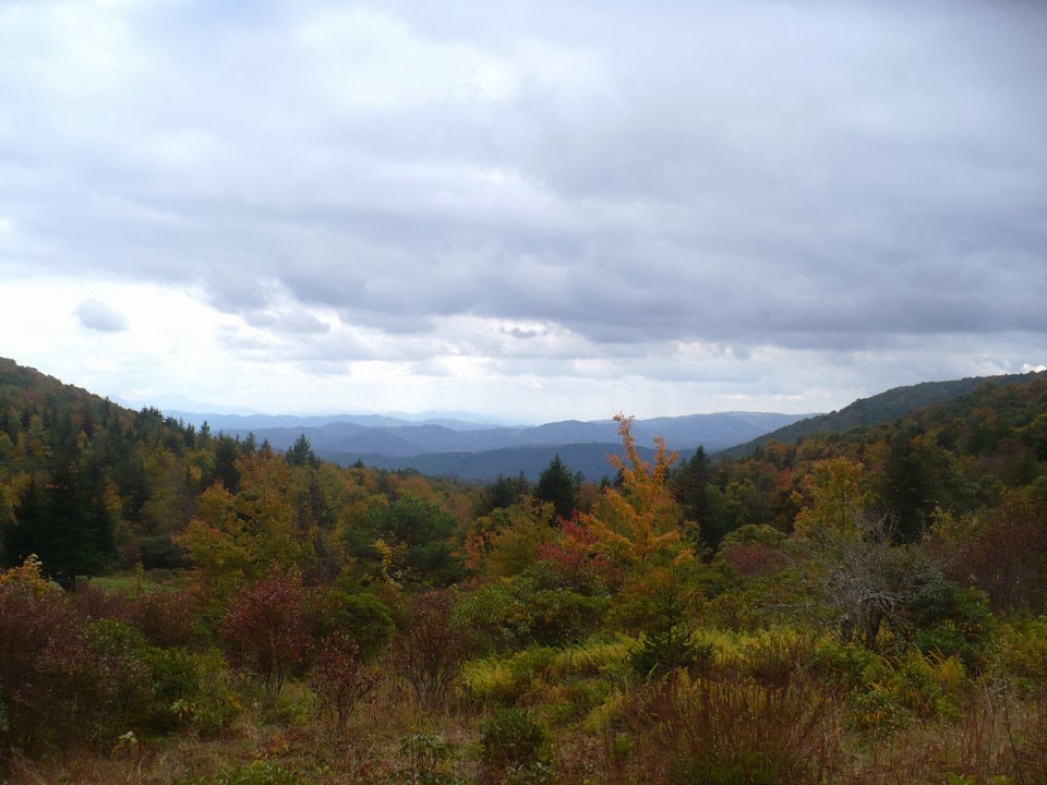
The landscapes and scenery at this altitude is breath taking!  It is a beautiful hike. We passed many folks hiking, riding horseback and others who had set up their camps. There were bear warnings posted, and we hiked for several miles without seeing any of the ponies we were hoping to see.


We were quite surprised to see a few cows grazing along the trail.  


More views of the blue ridge.  It really is a fabulous hike. It's only a couple hours drive, we really should be hiking here more often.  After hiking pretty far up the trail we were feeling a bit disappointed that we hadn't seen any ponies.  We began to head back, and although we thought we were retracing our original path, we somehow ended up on a different trail.


We came around a corner and found the ponies!!  The ponies are considered wild, but they are very use to all the hikers.  Folks tend to feed them and so the ponies are actually very tame.


As soon as they saw us they began to come over too see if we'd brought them any treats.


This pony has the most magnificent hairstyle i've ever seen. :)   He was absolutely gorgeous and very sweet!  The ponies even followed us for a while until some other folks stopped and pulled out carrots.

We really had a wonderful time hiking and seeing the beautiful ponies. i actually wish that we'd come earlier and had more time to hike. There are many other trails that are worth hiking, but we didn't have enough time to explore them.  We look forward to coming back again and may make the Fall festival and annual activity.

You can find out more about the Grayson Highlands here.